Prelims
Cyclone Akvan
Context: Cyclonic Storm ‘Akvan’, formed over the south-central Bay of Bengal, is expected to intensify into a Very Severe Cyclonic Storm (VSCS) before making landfall between Nellore and Tuni along the Andhra Pradesh–Yanam coast.

About Cyclone Akvan:
What it is?
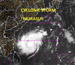
- A tropical cyclone developing in the North Indian Ocean (Bay of Bengal) during the 2026 post-monsoon cyclone season—marking the third consecutive cyclonic storm in the basin within a month following Cyclones Arnab and Murasu.
Origin & Naming:
- Meteorological Origin: Developed from a low-pressure area over the Bay of Bengal, intensifying into a Deep Depression on November 16 before strengthening into Cyclonic Storm Akvan.
- Nomenclature: Named ‘Akvan’ by Iran under the WMO/ESCAP tropical cyclone naming system, inspired by a mythological giant in Persian literature.
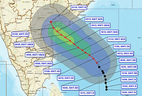
Projected Track & Landfall: Moving northwestward, Cyclone Akvan is forecast to intensify into a Very Severe Cyclonic Storm (VSCS) before making landfall between Nellore and Tuni.
Formation of a Tropical Cyclone:
Tropical cyclones are intense low-pressure systems forming over warm oceans, driven by moisture condensation and latent heat release. Six major conditions favour their formation:
- Warm Sea Surface Temperatures: Ocean temperatures above 26.5°C–27°C, extending to sufficient depth, provide the heat and moisture required for cyclone development.\
- Sufficient Coriolis Force: Earth’s rotation generates cyclonic circulation, generally preventing cyclone formation within approximately 5° latitude of the Equator.
- Pre-existing Low-Pressure Disturbance: An initial low-pressure area, trough or atmospheric disturbance triggers surface wind convergence and rising air, initiating cyclone formation.
- High Mid-Tropospheric Humidity: Sufficient moisture at 5–7 km altitude sustains deep convection and prevents dry air from weakening developing storm clouds.
- Low Vertical Wind Shear: Weak variations in wind speed and direction with altitude maintain the cyclone’s vertical structure, supporting organisation and intensification.
- Upper-Tropospheric Divergence: Strong upper-level outflow removes rising air, sustaining low surface pressure and continuous upward movement within the cyclone.
Why More Cyclones Form During the Retreating Monsoon Than the Southwest Monsoon?
- Reduced Vertical Wind Shear: Strong monsoon winds and the Tropical Easterly Jet inhibit cyclone development, while weakening post-monsoon winds favour cyclone organisation and intensification.
- Warm Sea Surface Temperatures: Post-monsoon Bay of Bengal temperatures of around 28°C–30°C provide abundant oceanic heat and moisture, supporting cyclone formation and intensification.
- Favourable ITCZ Position: During monsoon withdrawal, the Inter-Tropical Convergence Zone (ITCZ) shifts southward over the Bay of Bengal, favouring cyclone development over warm waters.
- Remnants of Pacific Typhoons: Low-pressure remnants from Western Pacific storms can enter the Bay of Bengal and regenerate under favourable oceanic and atmospheric conditions.